图文阅读:The East African Rift Valley(触摸地球的伤疤)
日期:2008-03-12 12:40
(单词翻译:单击)
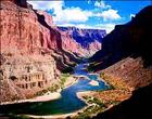
In geology, fracture in the earth's crust in which the rock on one side of the fracture has measurable movement in relation to the rock on the other side. Faults on other planets and satellites of the solar system also have been recognized. Evidence of faults are found either at the surface (fault surface) or underground (fault plane).
在地质学中,地壳岩石断裂的一边以可测量的移动到岩石的另一边。这是由于太阳系总其他行星和卫星发生故障.断裂明显的特征显示在断裂表层以及里层

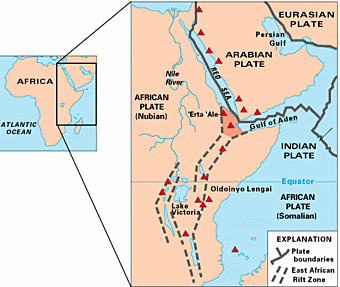
It extends 3,000 mi (4,830 km) from N Syria to central Mozambique. The northernmost extension runs through Syria and Lebanon, the Jordan valley, the Dead Sea, and the Gulf of Aqaba. It continues into the trough of the Red Sea and at the southern end branches into the Gulf of Aden, where it continues as part of the Mid-Oceanic Ridge of the Indian Ocean.
它从叙利亚延伸3000米(4830公里)到莫桑比克中部. 最北穿过叙利亚和黎巴嫩,越过约旦河谷、死海和亚喀巴湾. 它继续深入穿越红海最南的山脉延伸到了亚丁湾,作为印度洋中心桥梁的重要一部分.
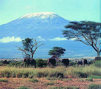
The main section of the valley in Africa continues from the Red Sea across Ethiopia and across Kenya, Tanzania, and Malawi to the lower Zambezi River valley in Mozambique. Many small lakes in Ethiopia and several long narrow lakes, notably lakes Turkana and Nyasa, lie on its course. Just N of Lake Nyasa there is a western branch, which runs north, chiefly along the eastern border of Congo (Kinshasa); this branch is marked by a chain of lakes, including lakes Tanganyika, Kivu, Edward, and Albert (Mobutu).
大峡谷的主体部分来自非洲,延伸自红海穿过埃塞俄比亚,横跨两岸的肯尼亚、坦桑尼亚、马拉维到莫桑比克的赞比西河流域下游. 埃塞俄比亚的许多湖泊和几个狭长的小湖泊,尤其是图尔卡纳湖和尼亚萨湖. 刚好尼亚萨湖的有一个西部分流向北流,主要沿着刚果的东部边界(金沙萨);这条分支连接了许多湖泊包括了坦噶尼喀湖、基伍湖、爱德华湖、艾伯特湖(蒙博托).
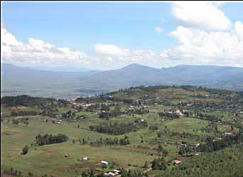
Lake Victoria does not lie in the Great Rift Valley but between its main and western branches. The Great Rift Valley ranges in elevation from 1,300 ft (395 m) below sea level (the Dead Sea) to 6,000 ft (1,830 m) above sea level in S Kenya. Erosion has concealed some sections, but in places, notably in Kenya, there are sheer cliffs several thousand feet high. The present configuration of the rift, which dates from the mid-Pleistocene epoch, is probably a result of a rifting process associated with thermal currents in the earth's mantle elongated depression, trough, or graben in the earth's crust, bounded on both sides by normal faults and occurring on the continents or under the oceans. The central flat block forming the trough slips downward relative to the crustal blocks on either side. The appearance is that of a fallen keystone in a broken arch. There is evidence of earlier rift structures.
维多利亚湖不列于大裂谷,但是位于大裂谷主要的山脉及西部分支。大裂谷的范围从海拔从海面以下(死海)1300英尺(395米)到海平面以上6000英尺(1830米)肯尼亚南部的海平面. 部分区域的腐蚀被隐藏起来,但在有些地方,特别是在肯尼亚,有数千英尺高的悬崖. 目前的断裂结构,显示来自中世纪,也许是由于断裂的过程中与热气流在地球地幔被低压延伸到地壳地堑中,位于断层的两侧正常断裂并且断裂发在陆地或者海洋.中心的平地阻止了滑槽向地壳的两边下降. 外貌看起来是由倒下的拱形石破裂成拱形.这显示了早期的裂痕结构.
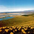
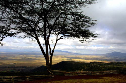
有许多人在没有见东非大裂谷之前,凭他们的想象认为,那里一定是一条狭长、黑暗、阴森、恐怖的断涧深,其间荒草漫漫,怪石嶙峋,涉无人烟。其实,当你来到裂谷之处,展现在眼前的完全是另外一番景象:远处,茂密的原始森林覆盖着宫绵的群峰,山坡上长满了盛开着的紫红色、淡黄色花朵的仙人滨、仙人球,近处,草原广袤,翠绿的灌木丛散落其间,野草青青,花香阵阵,草原深处的几处湖水波光闪,山水之间,白去飘荡。裂谷底部,平平整整,坦坦荡荡,牧草丰美,林木葱茏,生机盎然。
东非大裂谷地区的这一系列考古发现证明,昔日被西方殖民主义者说成的"野蛮、贫穷、落后的非洲",实际上是人类文明的摇篮之一,是一块拥有光辉灿烂古代文明的土地

重点单词

